We had some days off work and got the caravan ready for another expedition in Spain.
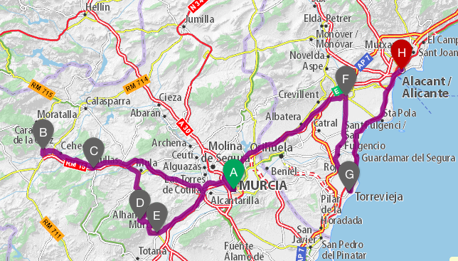
The province we chose this time was Murcia, but not the coast with the Mar Mayor and Cartagena but the inland.
Via Verde
We wanted to be active so on the first day we headed to the city of Murcia, where a long Via Verde starts – the Via Verde del Noroeste with 76,8 km – a former train line and now a cycling route.
The route begins near the University and we could easily park just next to the old train route. (38°00’58.1″N 1°10’29.4″W)
Day 1
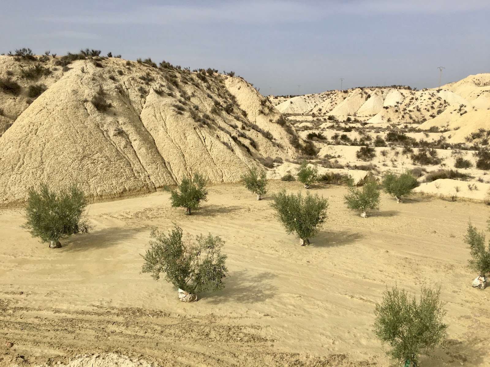
The first part of the Via Verde was not very interesting as we passed mostly towns and industrial areas, but after Alguazas we reached the badlands which are really impressive with their greenish bare soil formed by the little rain this area gets.
We lost the track and headed up the wrong hill so involuntary we did some more kilometres.
Our plan was to do half the route on the first day, but when we reached Campos del Rio after 2h15min and 22,7 km we decide to turn around as it was already 4pm.
We are much faster on the way back and reached the caravan just before 6pm, where we had a shower – what a luxury to have your house with you !!
Leaving the city we drove west to Mula, where the town has set up a caravan parking next to the sport complex. (38°02’22.0″N 1°28’55.1″W)
It was still warm so we sat outside and looked up at the castle of Mula, with a glass of rosado from Navarra in hand and some old Gouda.
What a great day !
 |
| amazing badlands |
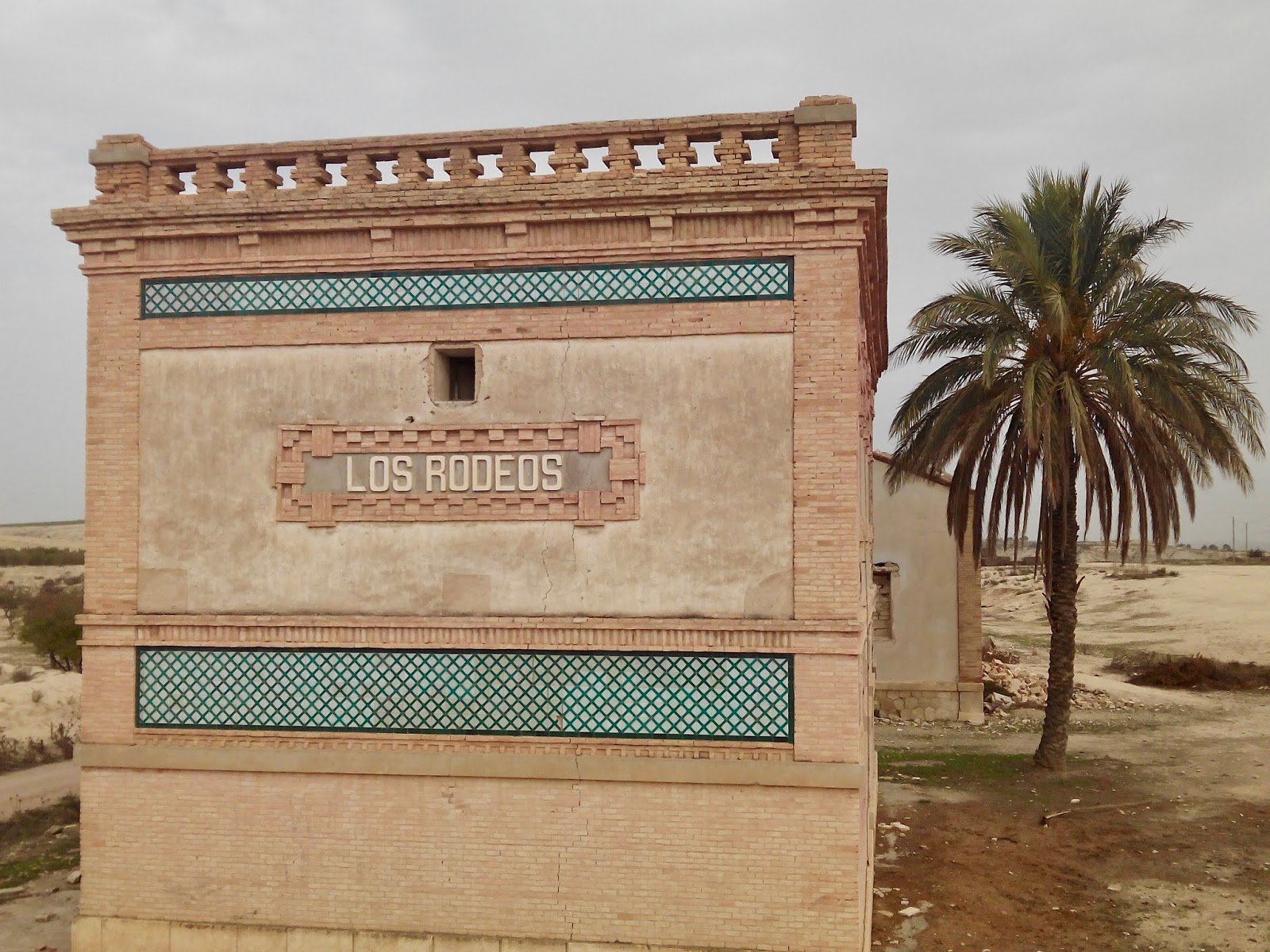 |
| one of the old train stations along the way |
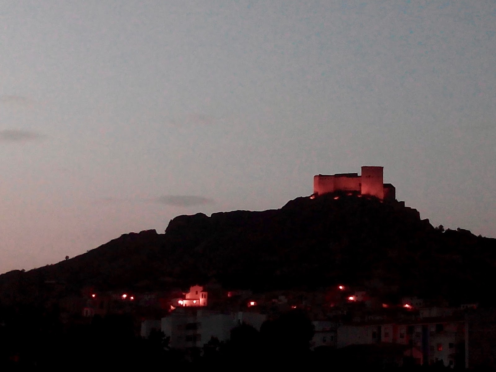 |
| the castle of Mula from the caravan parking |
Day 2
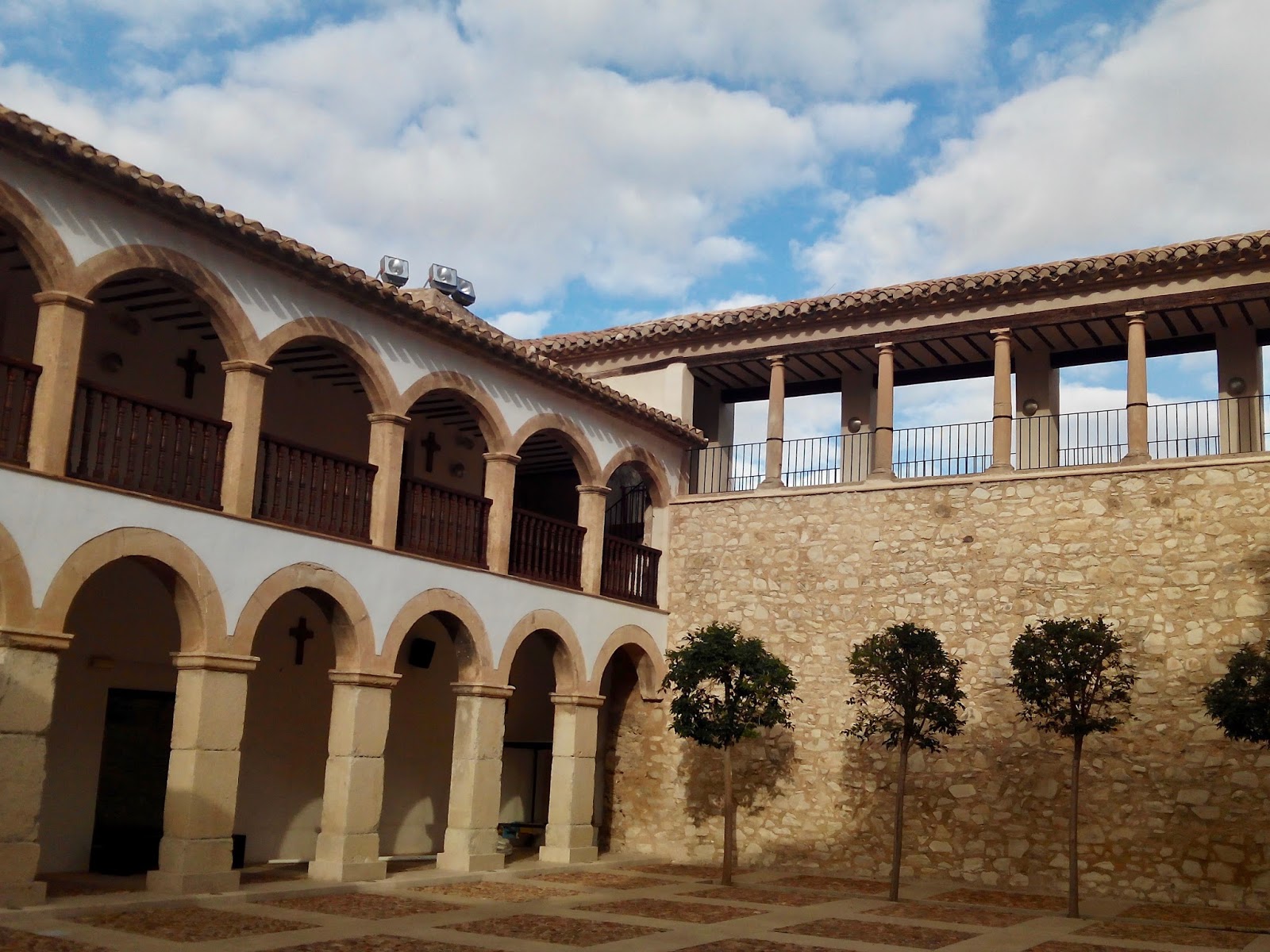
The next day we visited the tourist information situated in a beautifully restored convent not far from our parking to get informations about Mula and it’s surroundings.
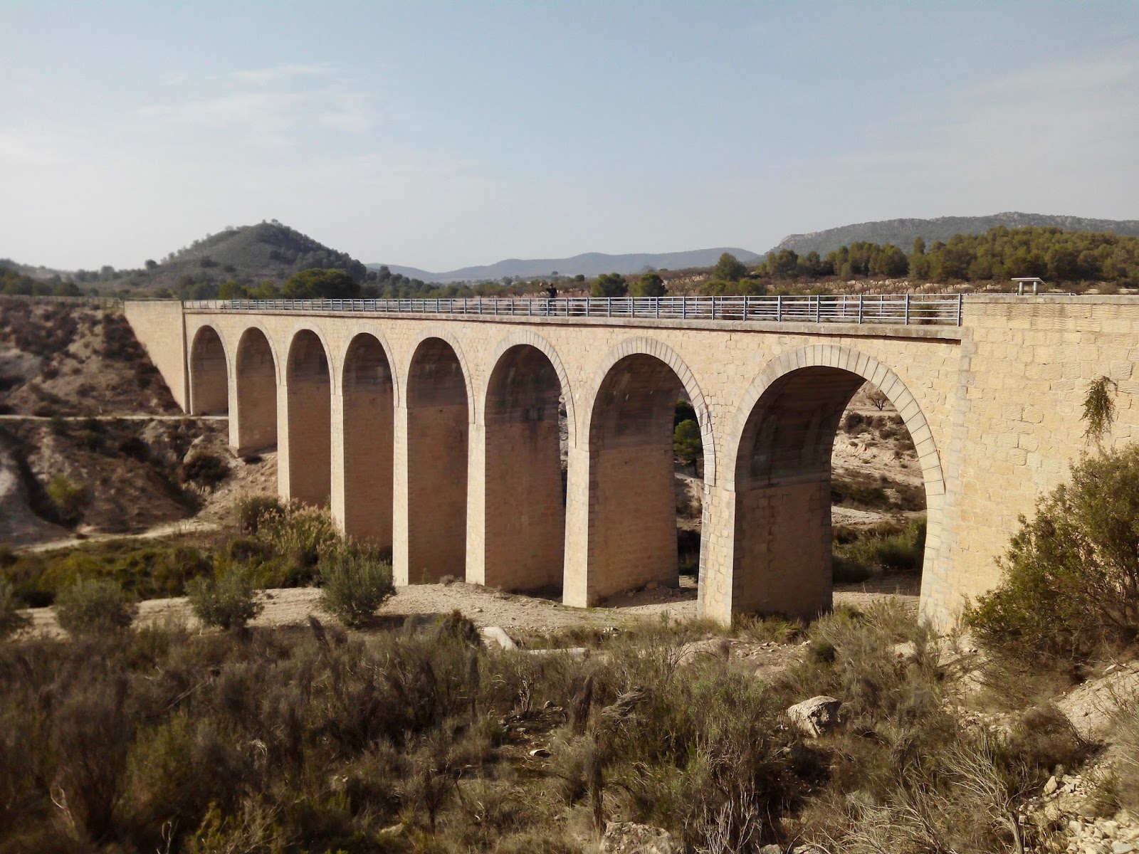
Afterwards we followed the Via Verde again, which passed close to our parking, until Bullas. It’s uphill all the way and quite tiering. We passed the Sanctuary del Niño, a couple of short tunnels and a viaduct before we reach Bullas after 2 hours and 19 km. We mad a big circle through town before we stopped at a Tasca for lunch. On the way back, we had the wind in our faces, but it was still much easier than to go uphill. The area is very green with different cultivations and also pine trees, a difference to the badlands from the day before.
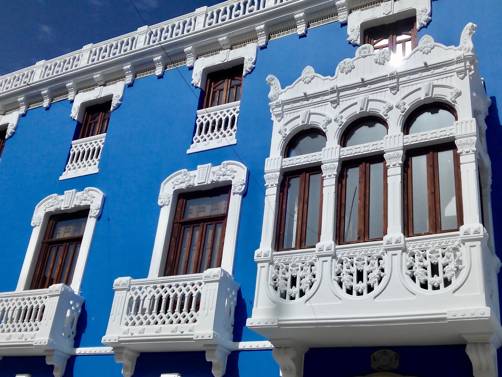
Back at our camper, we sat a little bit in the sun before we walked into Mula. Our first stop was the museum Fundacion Casa Pintada, which has a beautiful facade and houses the work of the local painter Cristobal Gabarrón. Most of his work is very colourful and some reminded us of Miró.
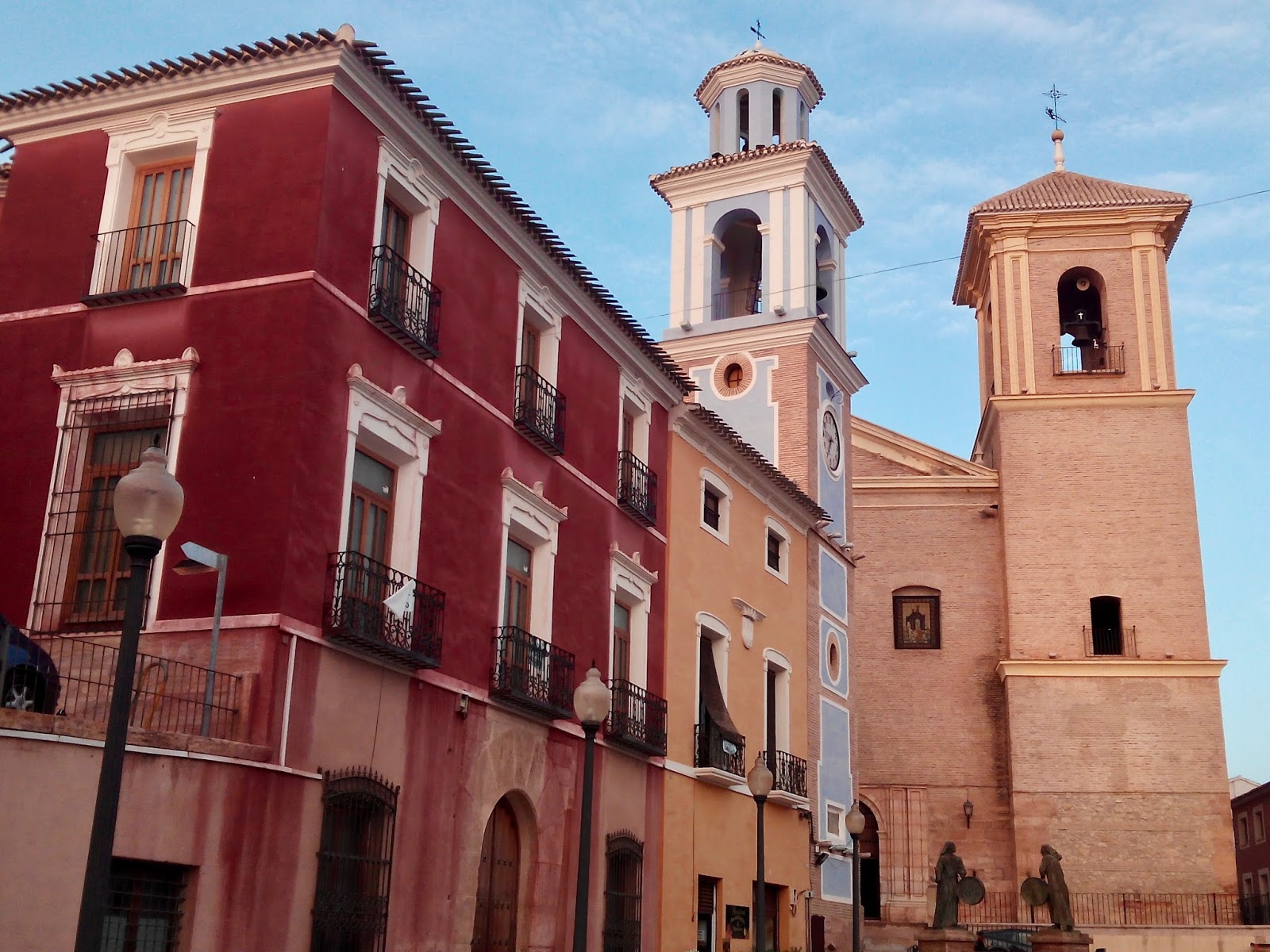
We walked past the museum El Cigarralejo, which was closed but the building is also an interesting palace, before we walked uphill to the Plaza del Ayuntamiento, where the blue clock tower, the Iglesia de San Miguel and the old casion form a beautiful city center.
Further uphill, we came past the Eremita del Carmen and the Iglesia de Santa Domingo just below the castle before we walked back down and home.
With a bottle of red wine, cheese and bread the day found an end.
 |
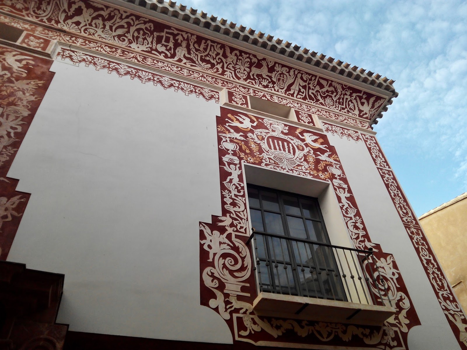
| Casa de Cultura in Bullas |
 |
| Detail of the entrance at the Casa de Cultura |
 |
| Casa Pintada – Mula |
 |
| Plaza del Ayuntamiento – Mula |
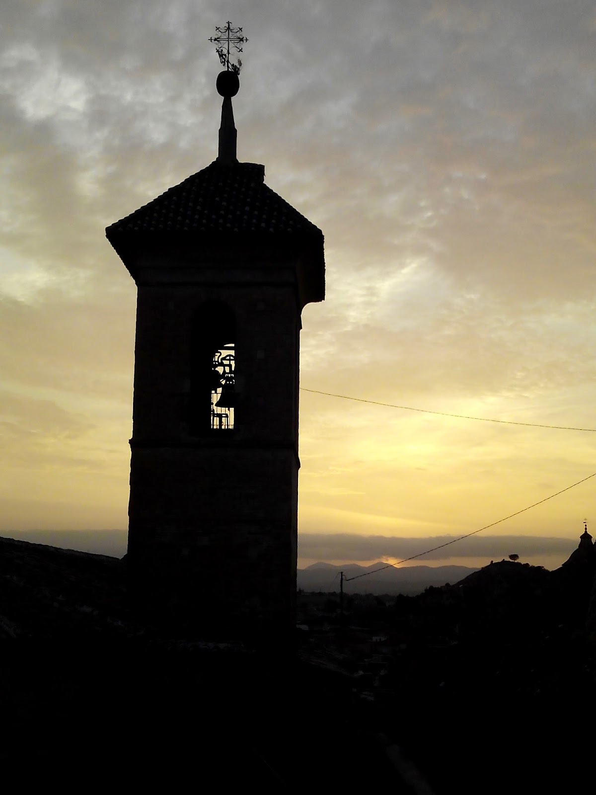 |
| Sunset at Mula |
Day 3
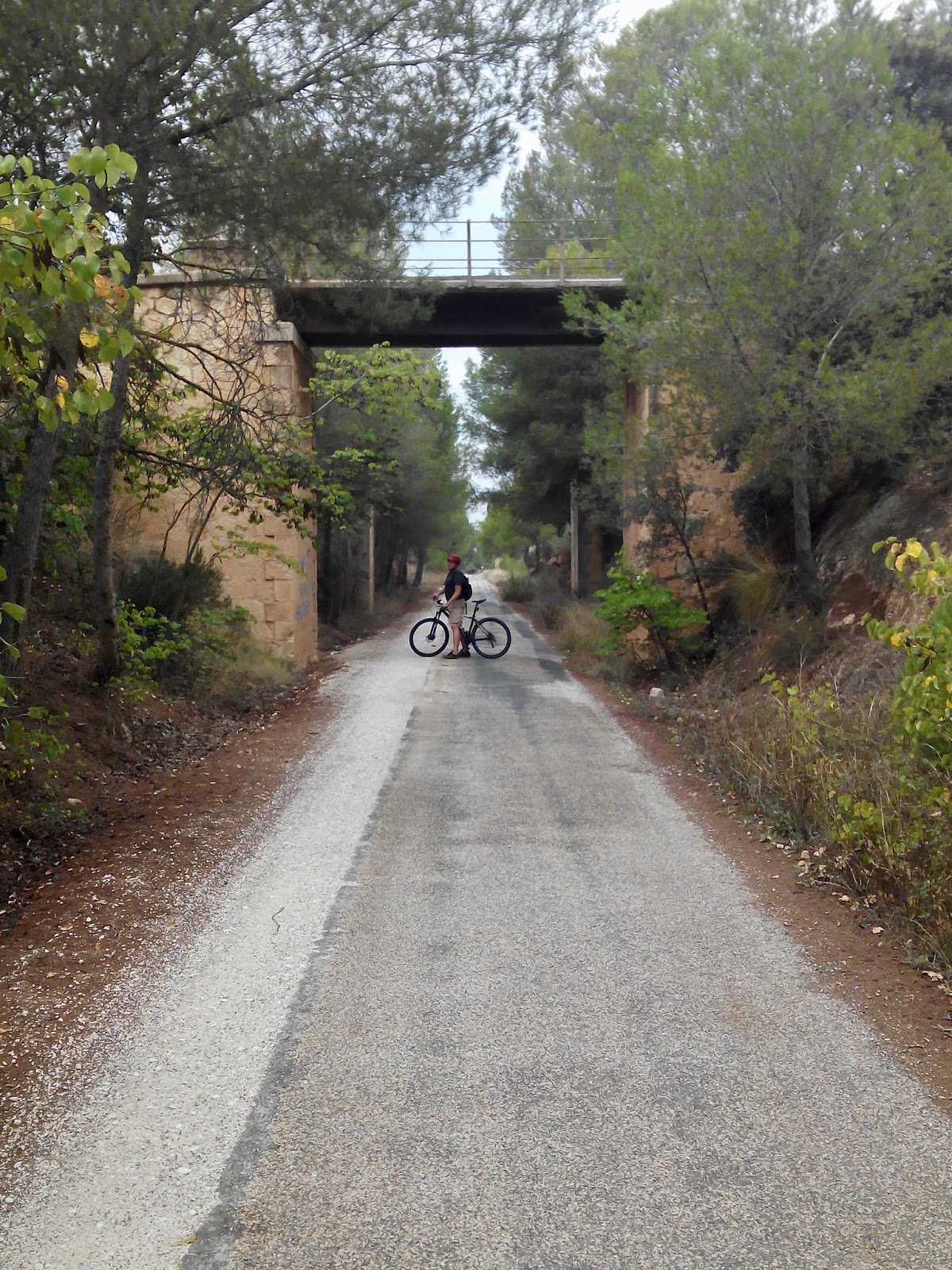
Instead of starting in Bullas today for the last part of the Via Verde, we drove to Caravaca de la Cruz and parked directly at the old train station where the via verde ends. (38°06’09.6″N 1°51’13.3″W) Starting from here, we could first cycle upwards to Bullas and later down again.
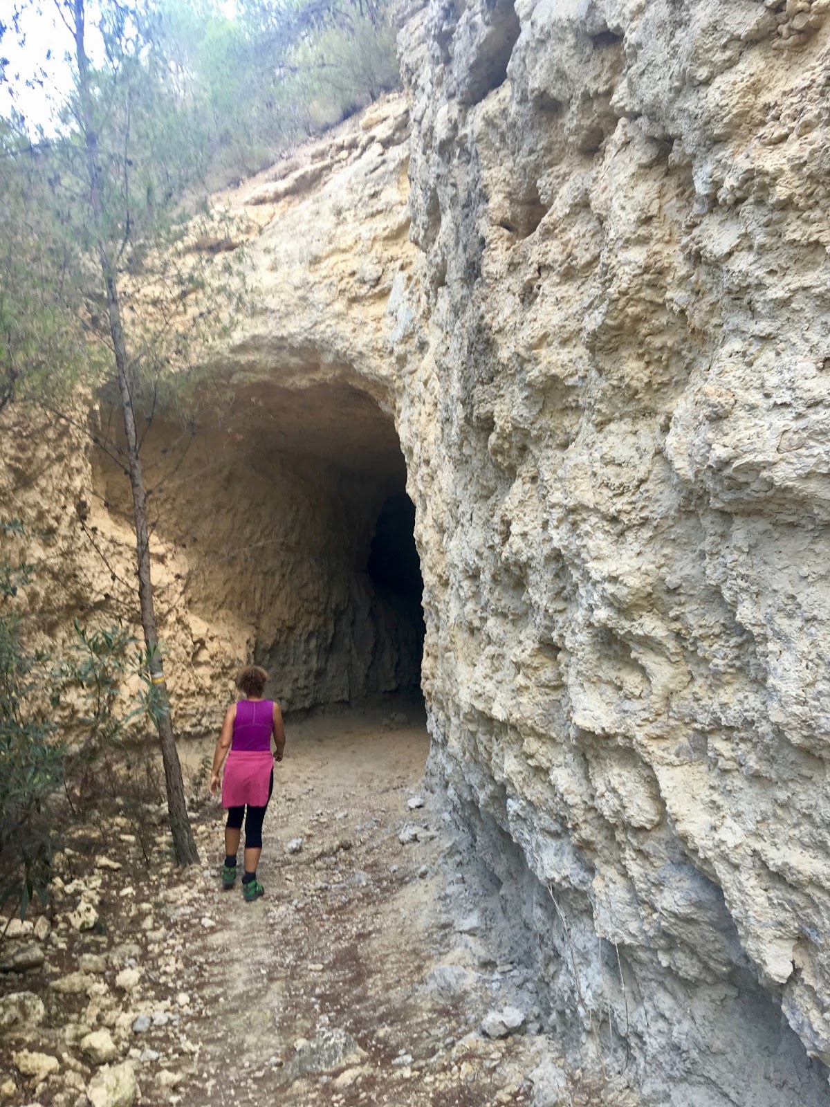
It was overcast and started to drizzle very soon, but the route was very nice, taking us through pine forests, over some viaducts and through one tunnel.
When we reach Bullas, we were wet and cold so we went into the first bar we saw and had some tapas while warming up. On the way back the drizzle was over and we could enjoy the landscape.
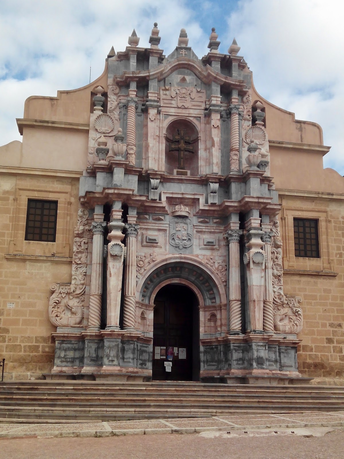
After a warm shower we left the caravan where it was and walk into Carvaca de la Cruz and up to the cathedral.
The sacristan opened us the chapel where the real cross is kept. Even if you are not religious, the importance of this cross for so many people makes it special. It was worth going up, the view was amazing and the cathedral was very interesting.
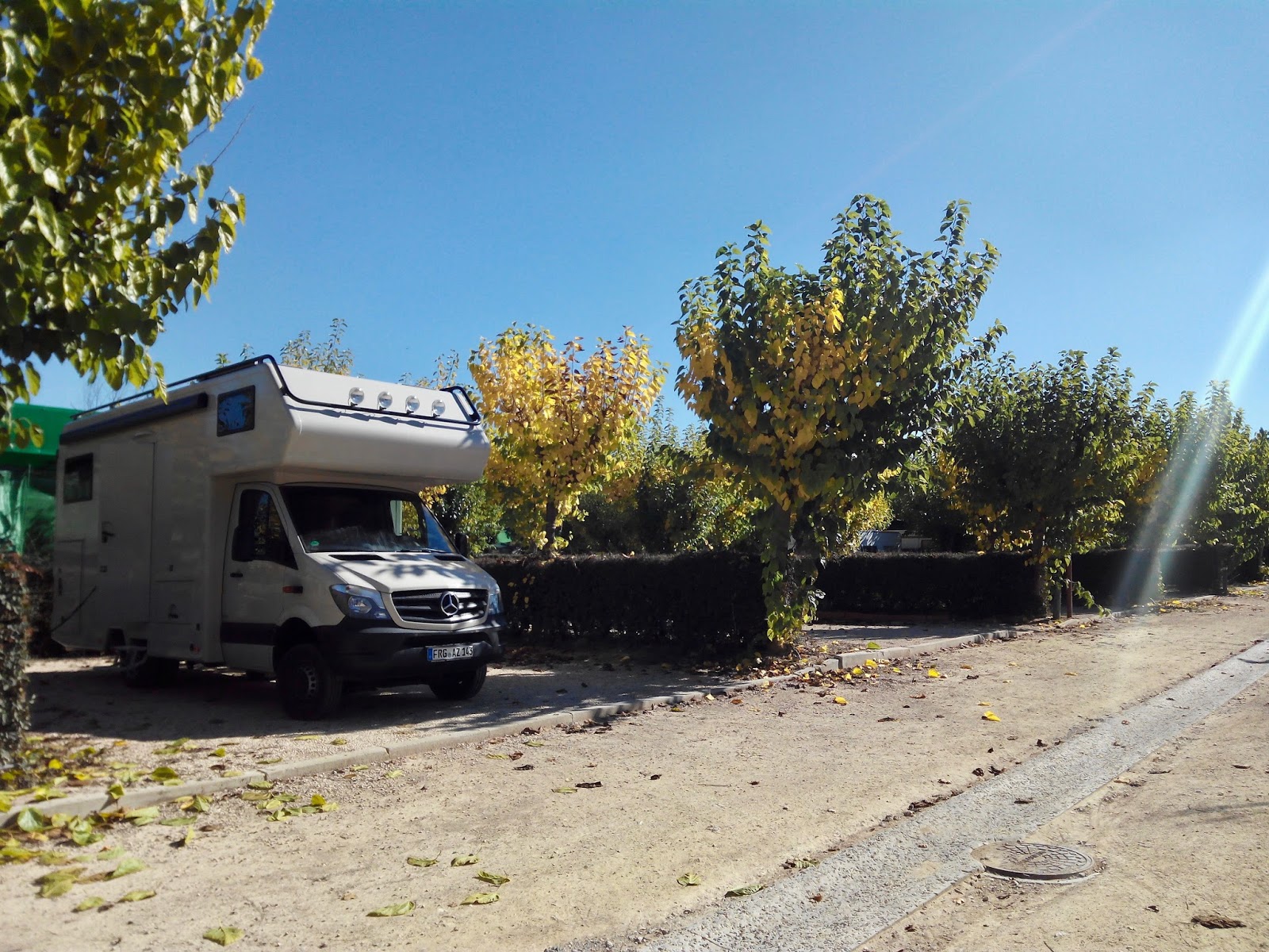
Returning to the caravan, we drove back to Bullas, to visit the wine museum (38°03’04.0″N 1°39’52.6″W). It is in an old wine cellar where you see the amphoras in the ground of the cellar where the wine was kept. The museum is new and very interesting. At the end we bought a bottle of the D.O. Bullas: Las Reñas Crianza, which we had with our dinner at Camping La Rafa that night and it was delicious! (38°02’12.6″N 1°40’12.0″W) The camping is just outside of Bullas and very green with a lot of permanent campers.
 |
| Via Verde between Bullas and Caravaca de la Cruz |
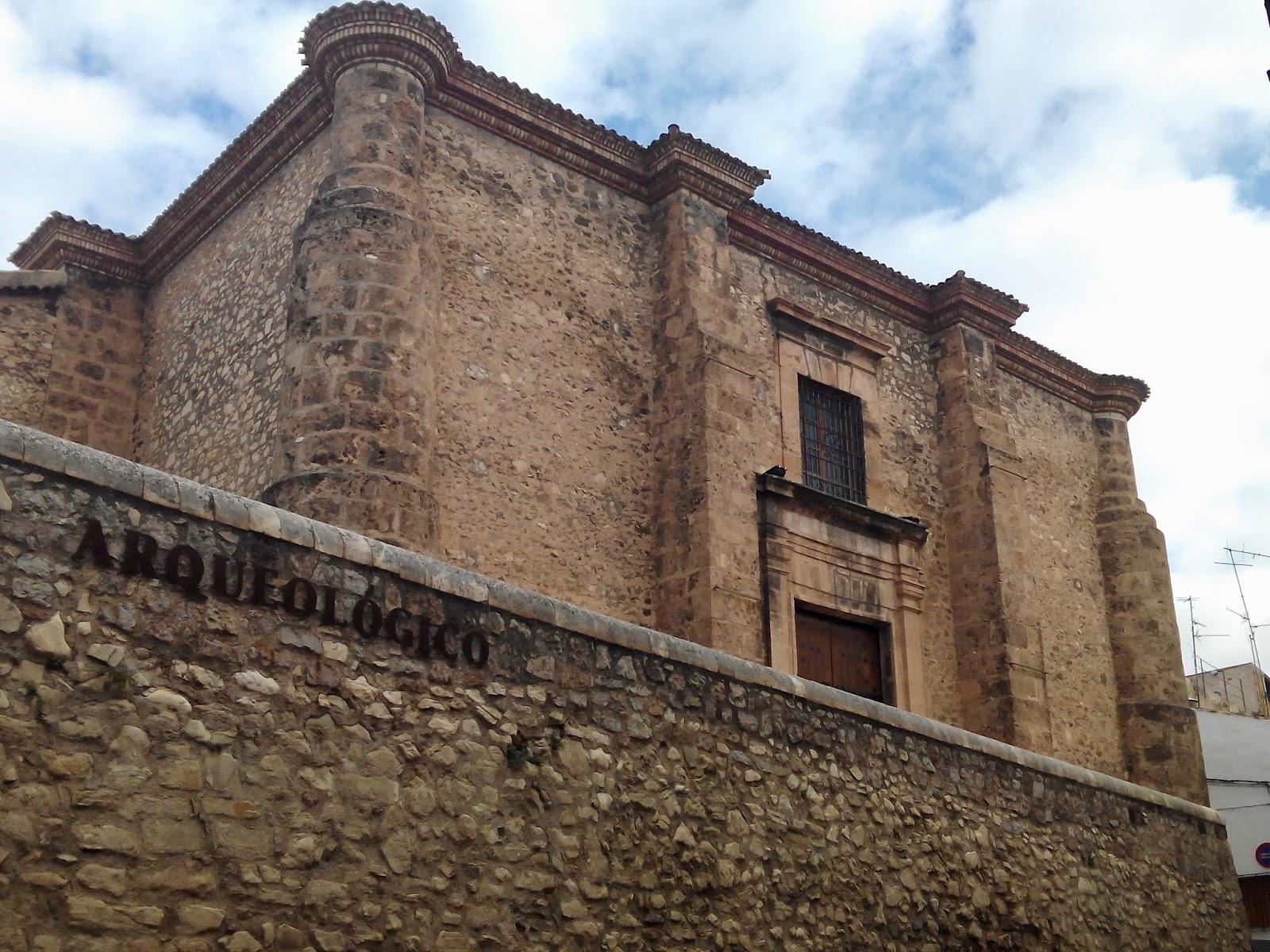 |
| Castle which houses the archeologic museum in Caravaca de la Cruz |
 |
| Santísima and Vera Cruz Basilica |
 |
| Convent next to the Basilica |
Day 4
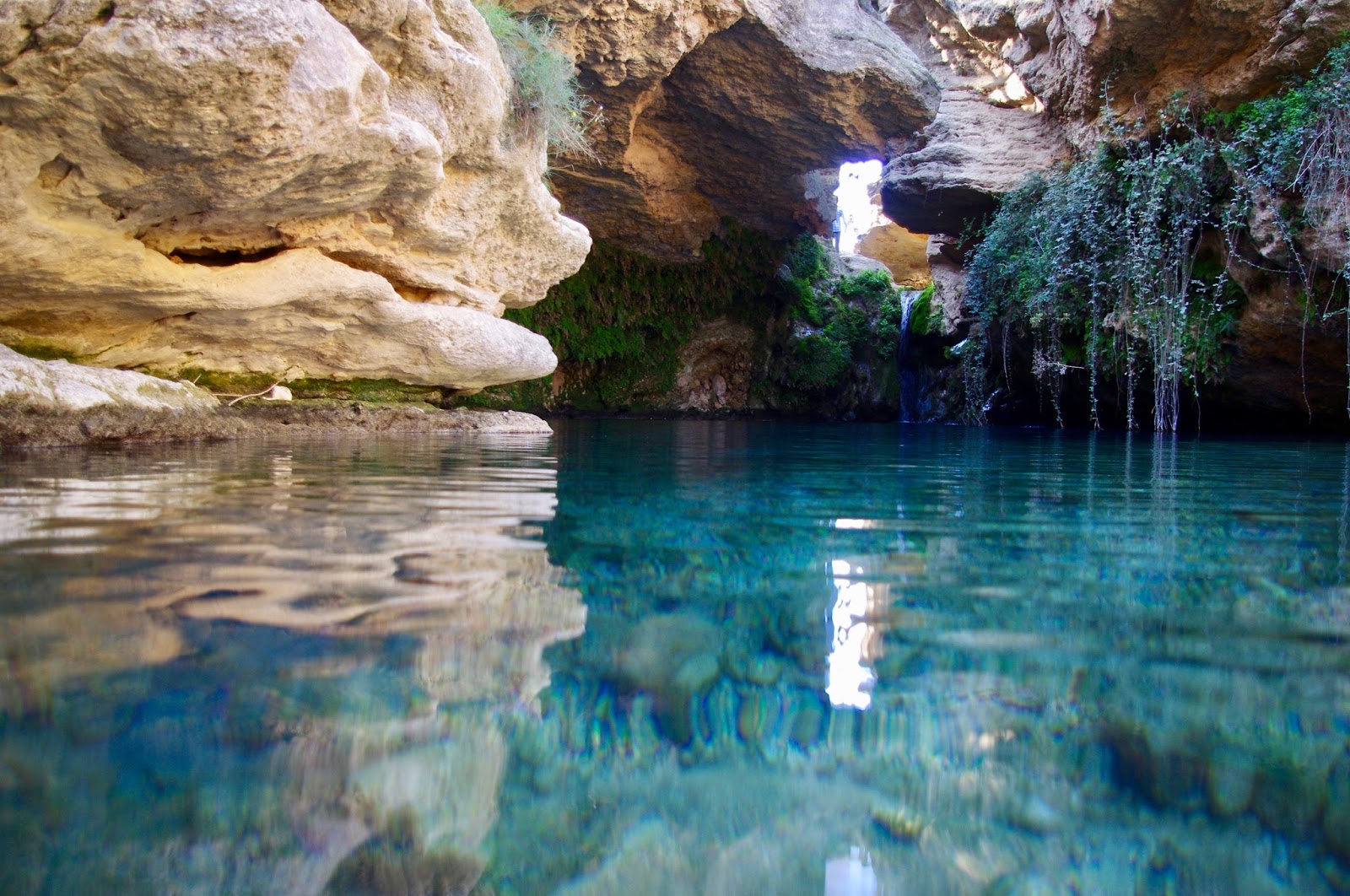
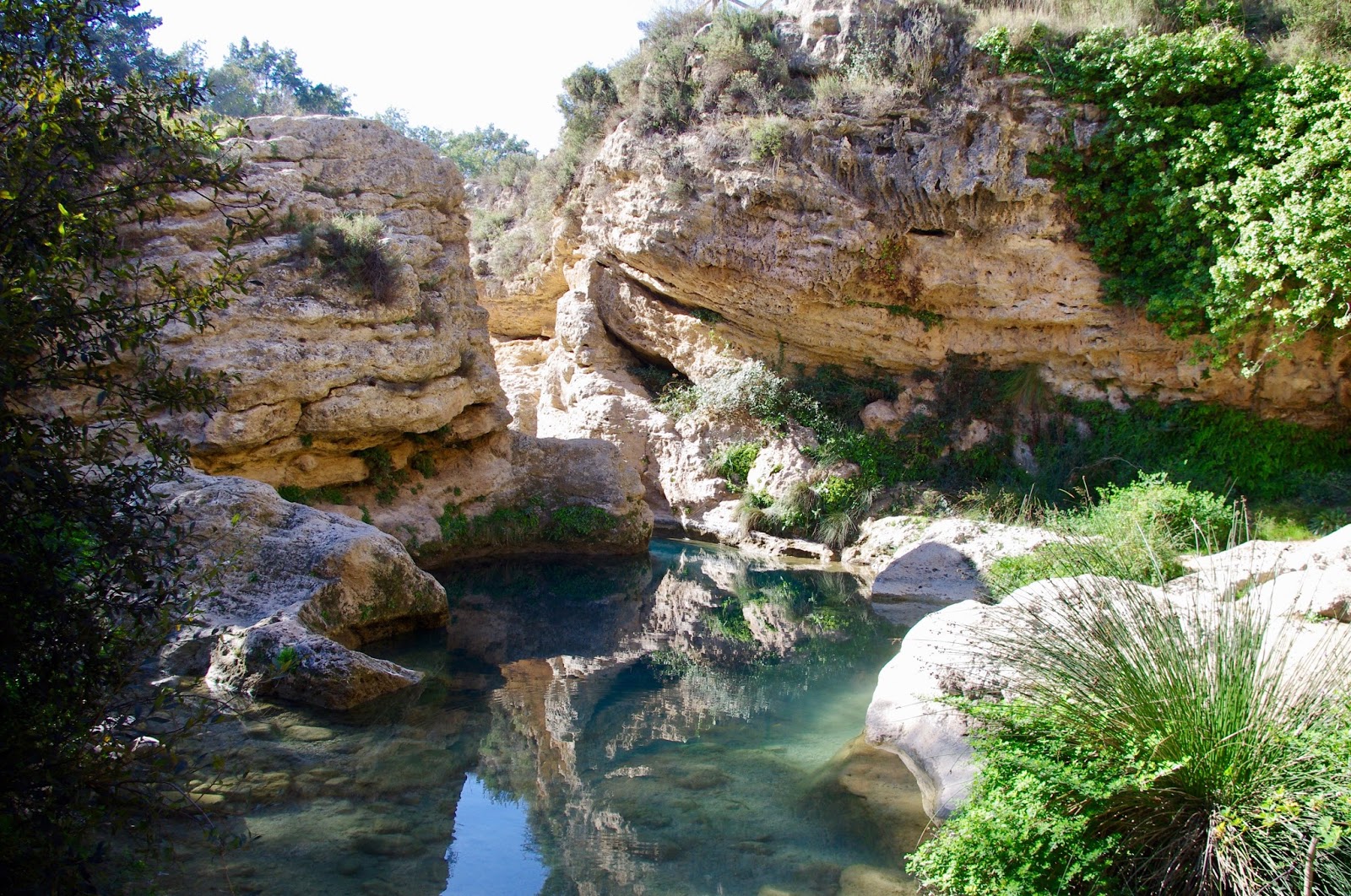
In the morning we took our time before we walked to the Salto del Usero. It was a half an hour walk from the camping. There is also a parking at the outskirts of Bullas from where you can start. (38°02’18.1″N 1°40’22.4″W) You can’t drive down to the waterfall, as the street ends at a beam with no parking possibility.
The waterfall is beautiful and something special if you bear in mind the arid surrounding. I would not recommend going there on a summer weekend, it will we packed.
When we returned to the camping site, a family had their weekend paella with flamenco guitar music accompanied by clapping and singing, others were just getting started with their barbacoa.
We left and drove back to Mula and via Pliego into the Sierra Espuña. After Pliego the street got windy and we drove uphill over a pass and through beautiful forests. We stopped at the Restaurante Mirador of Gebas, but they were very busy and didn’t have a table for us. We expected to see the lunar landscape of Gebas from there, but the Restaurant has no special view at all. So we drove a kilometre back and turned onto the road to El Berro where we were lucky to get one of the last spots at the Camping Sierra Espuña. (37°53’16.9″N 1°29’34.8″W)
The village lies in a valley and the street to get to the camping was quite small, but we made it. Part of the plots are covered, which is too low for us, but we got a nice spot at the top. For longer caravans this Camping is not recommendable.
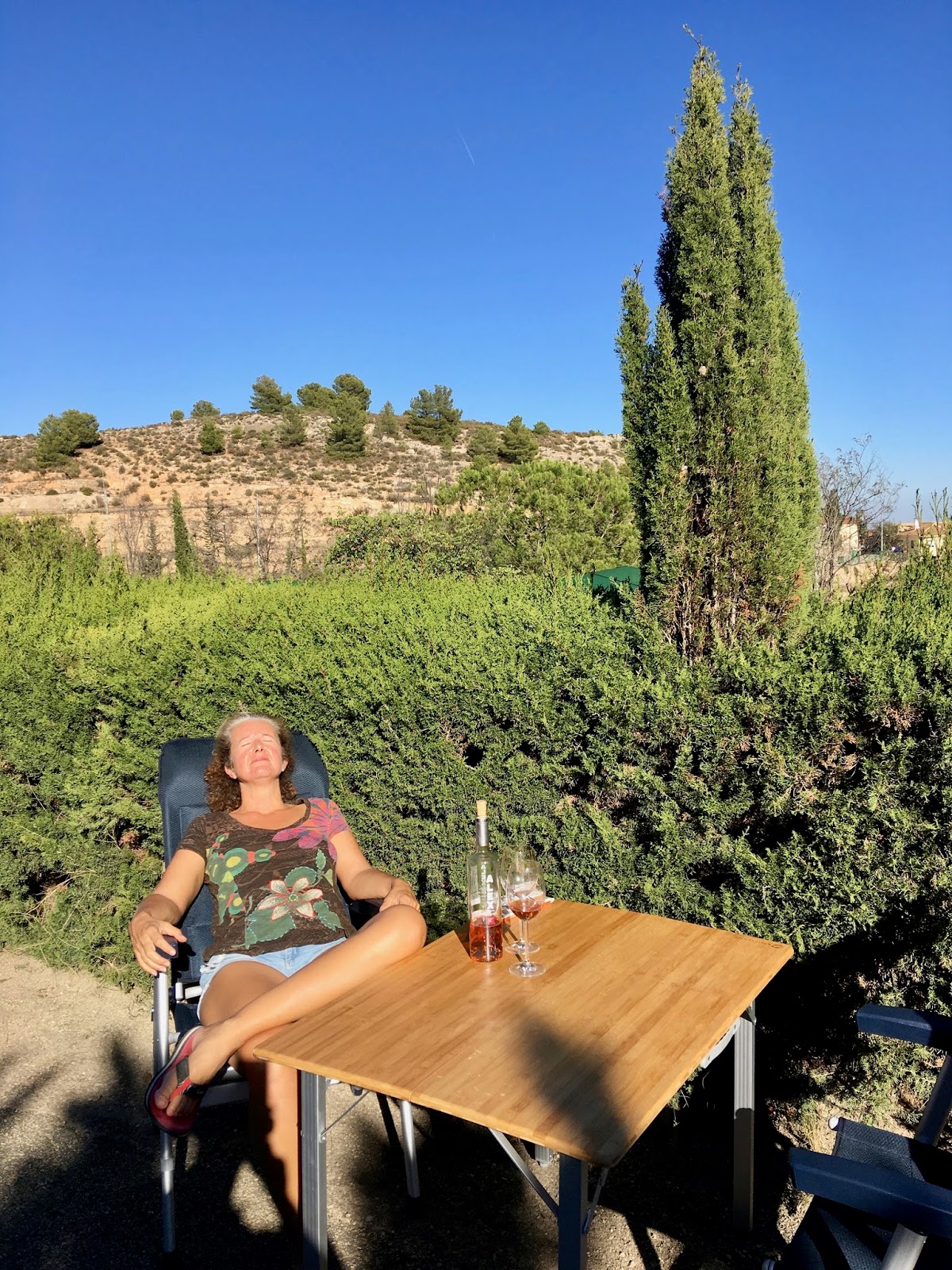
We prepare a nice lunch and sat in the sun as long as possible. When the sun was down we walked through the village which has 2 small supermarkets, a bakery, restaurants and bars. We stop at the bar close to the camping for some drinks, very nice owner.
We spend the rest of the evening with radio communication and scrabble.
 |
| Camping La Rafa – Bullas |
 |
| Salto del Usero – Bullas |
 |
| Salto del Usero – Bullas |
 |
| Relaxing at Camping Sierra Espuña |
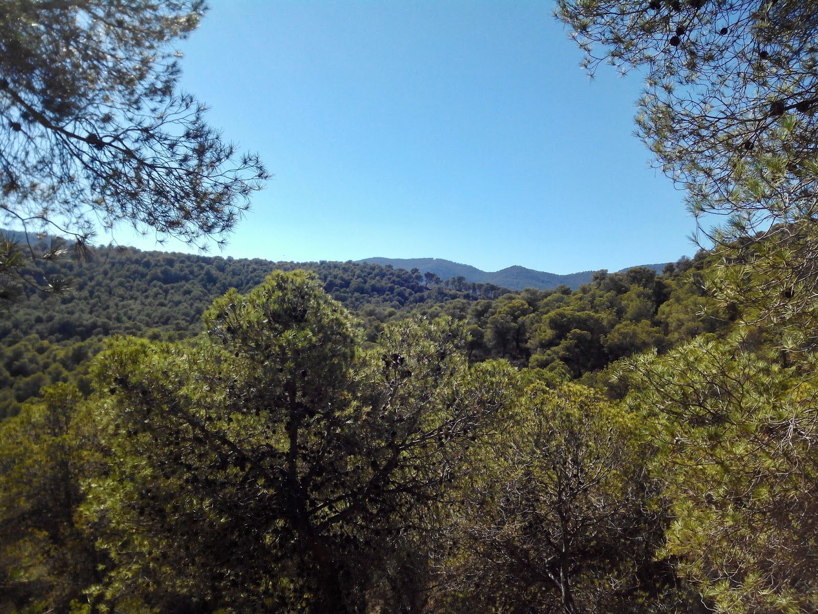
Sierra Espuña
Day 5
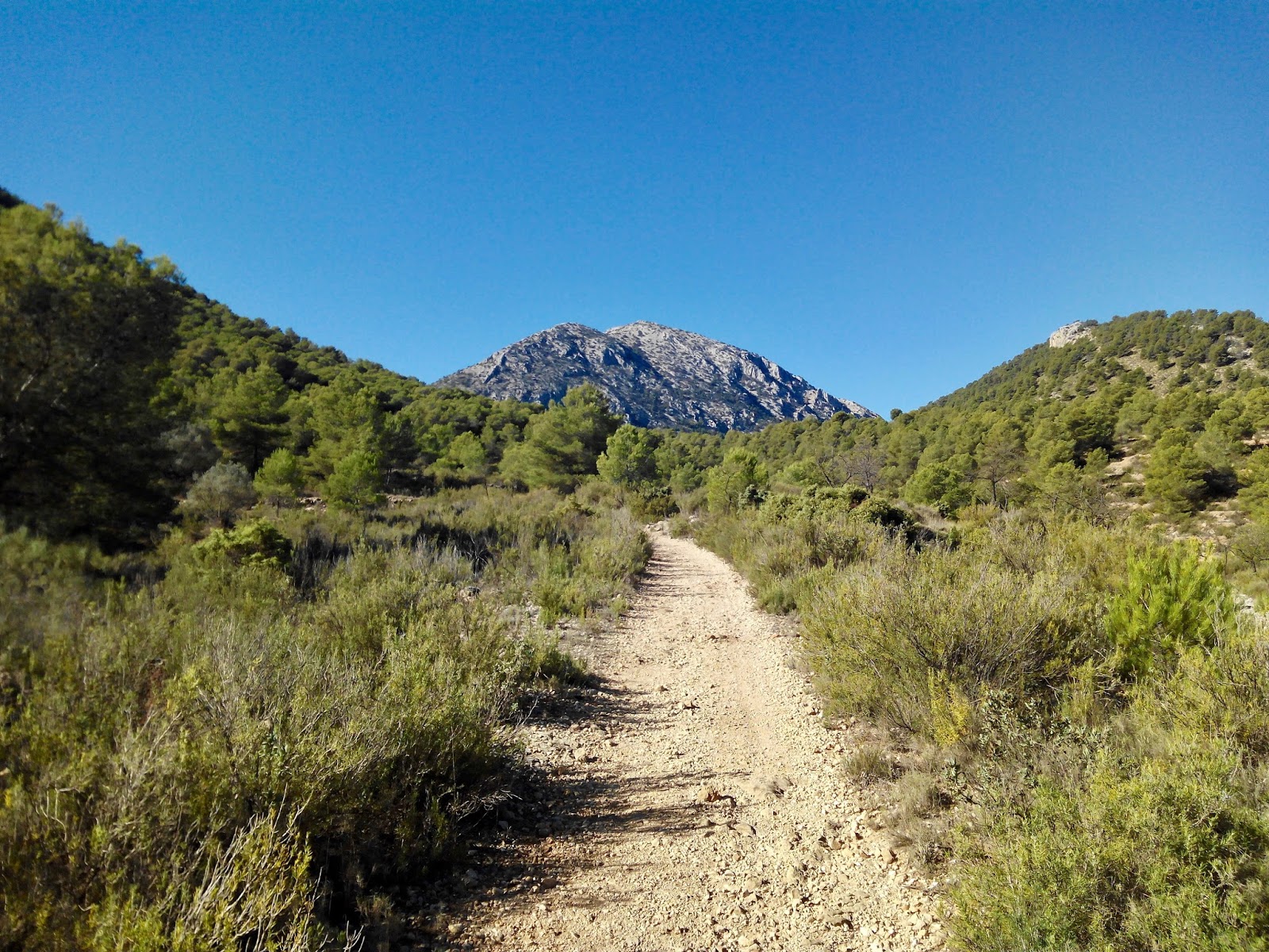
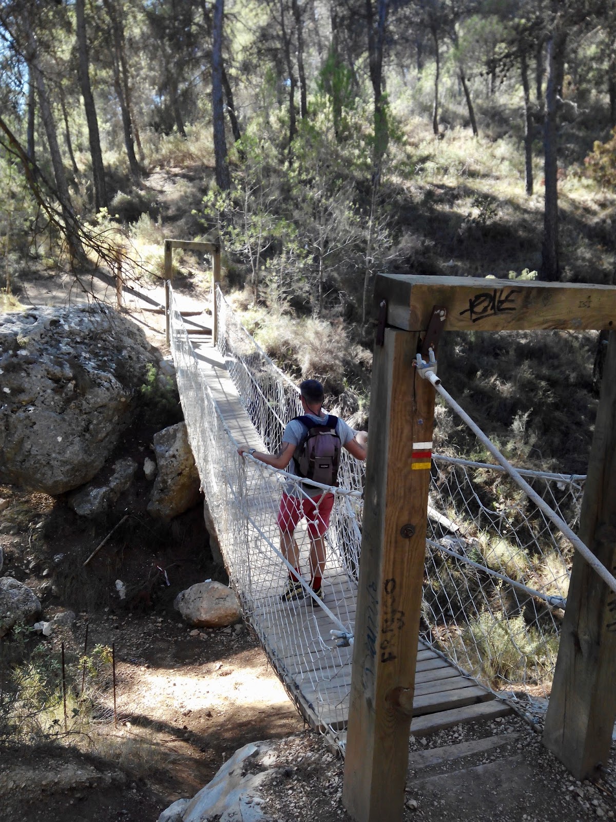
Today we left the camp on foot to discover Sierra Espuña. We got a map from the reception with 2 circular routes and we decide on the one leading into the mountains. It took us 3,5 h through mostly dense forests. We come past a suspension bridge and the abandoned sanatorium for tuberculosis. From a higher point we could see the vast extension of the forest, really special for this area.
The afternoon we relaxed and enjoyed the sun, interrupted by a visit to the restaurant next to the camping for a delicious home made cookie and chocolate cake with coffee and tea.
 |
| Sierra Espuña |
 |
| Nice trail through the Sierra |
 |
| Forest as far as you can see – something special for this part of Spain |
Day 6
Before we left, we tried to start early and do the second route from our map. It led us in the direction of Gebas and the route was amazing. The view over Gebas is spectacular, but we didn’t walk into the village to shorten the walk. On the way back we walked along a planned train route which was dug into the mountain, crossing a tunnel. As it looks like, the works stopped long before being finished. Later we walked along an old water channel before we reach El Berro again.
We left the way we came as recommended. There is another road coming up from the side of Alhama de Murcia which seems to be not very appropriate for caravans.
The road was winding and in not very good condition until Alhama de Murcia. We let the navigation guide us to Avd. Antonio Fuertes where we found a parking close to a nice looking restaurant.
We first walked into town, where we discovered that the museum of the roman bath was closed. We did a circle through the centre below the castle before we hurried back to the restaurant. We got so many nice starters that we were already full when the paella arrived, but we did our best. It was very delicious, the service was very good and the wine too. We really enjoy our lunch. (Restaurant La Masia, Avda. Antonio Fuertes, 54)
After this opulent meal we need a rest before we continued our way past Murcia to Elche, where we wanted to be at a specific shop before 6pm. We made it through the city to the address but the shop was closed 🙁
We left Elche again and drove to Torrevieja for our last day.
When we arrived, it was already dark and we took the first spot to park which we found online. (37°59’34.5″N 0°39’16.6″W)
We went for a walk, but the area was not very interesting. As we only wanted to sleep here, we didn’t look for a better place.
 |
| Unfinished railway track near El Berro |
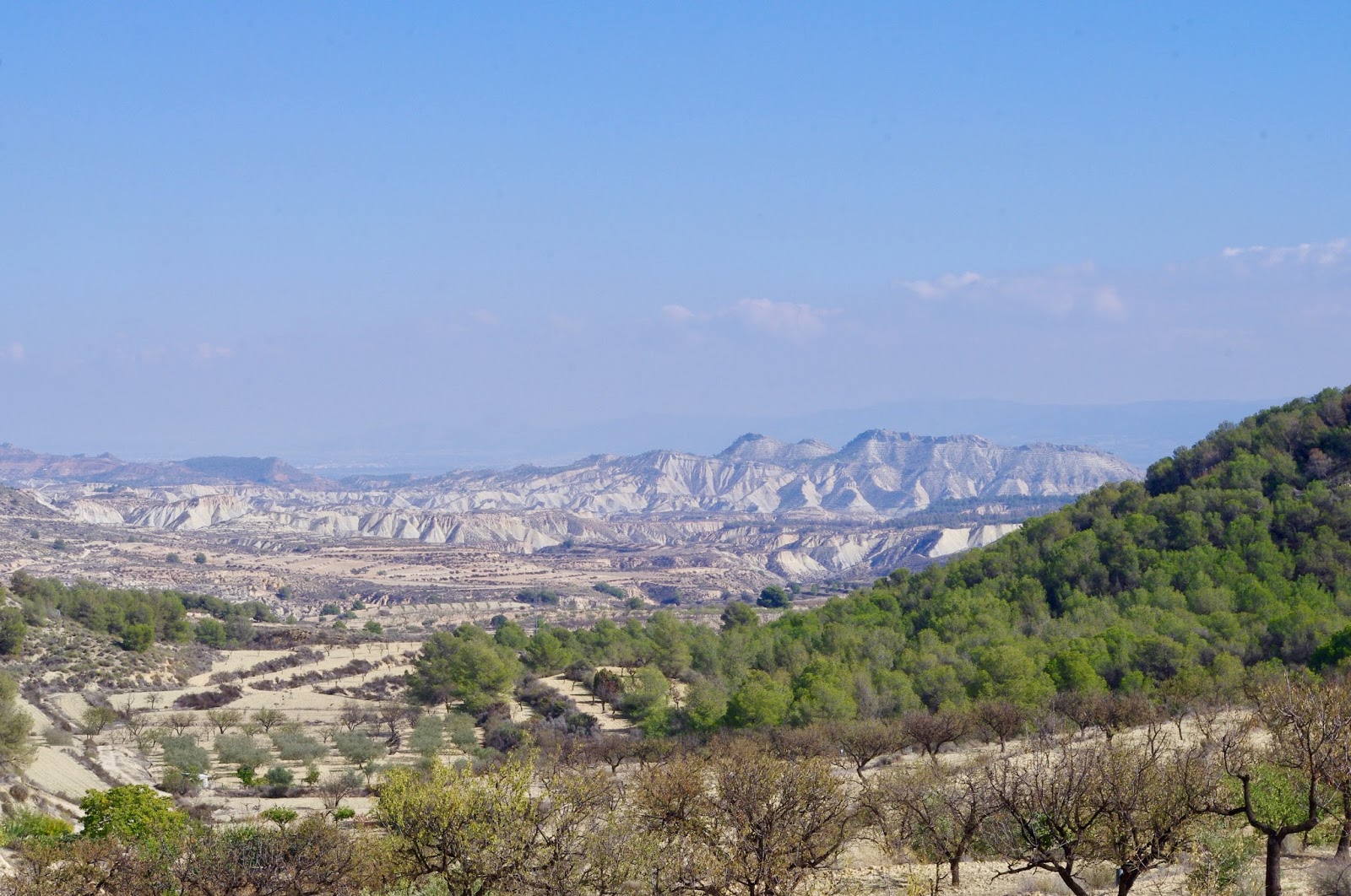 |
| View over the dry land around Gebas |
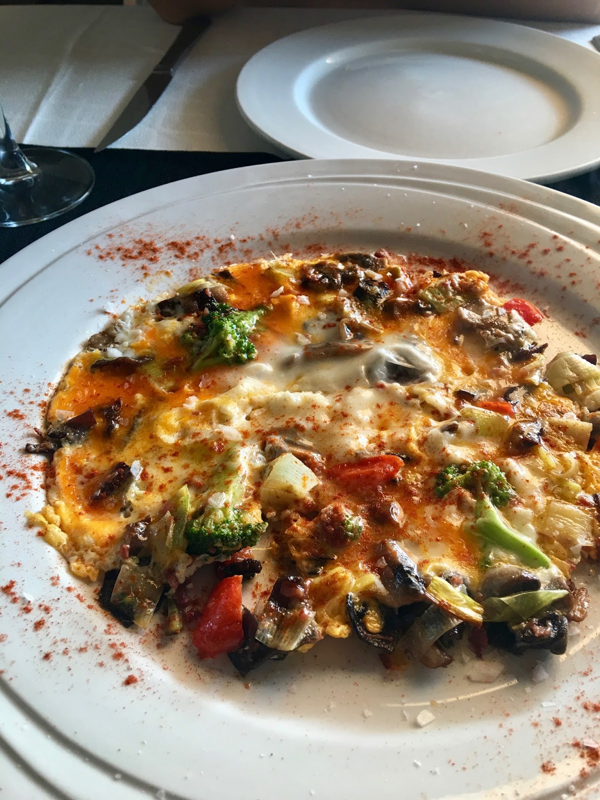 |
| Delicious Huevos Revueltos en Rest. La Masia |
 |
| Alhama de Murcia |
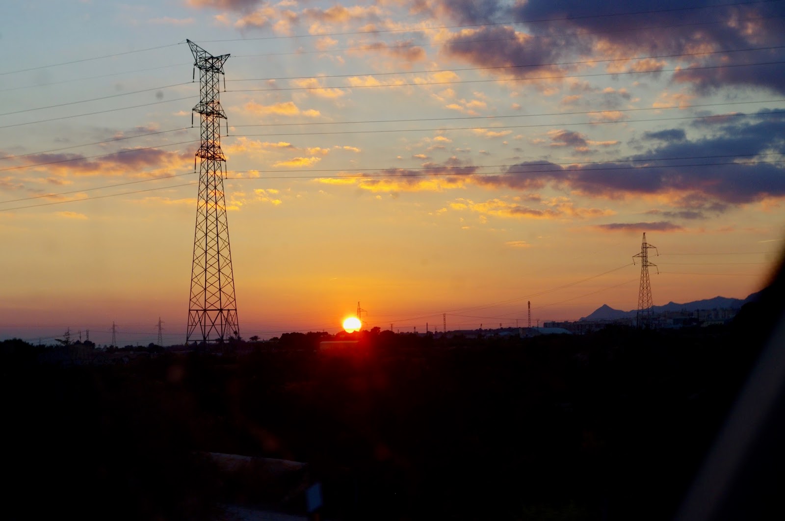 |
| Sunset south of Elche |
Day 7
During the night we heard cars coming and going which was a little disturbing.
In the morning we took our bikes and went first south to the center of Torrevieja. It has a big harbour, but no interesting beaches. The place could use some polish. There is a closer parking for caravans if you are interested to go there. (37°59’00.2″N 0°39’24.5″W)
We then took the direction north to La Mata. There are 2 beautiful beaches, one with restaurants and the second completely natural. In the middle is a place for caravans. So if you want some sun at the coast, I would go there. (38°01’45.3″N 0°39’01.3″W)
We turned inland to the smaller of the 2 lakes behind town. The intention was to make a circle around it but after getting lost in a half finished urbanisation and no nice route to follow we turned around and went back.
Torrevieja has a vast extension of small houses with little gardens and a very good infrastructure especially on the main road before you get into town. Big supermarkets and malls, a perfect place to do shopping.
When we were back at the camper, we packed up and drove north. We came past St. Pola and numerous flamingos before we turned off the N323 to go to the lighthouse from where you have a great view. (38°12’31.6″N 0°30’50.4″W) Down at the coast we saw small beaches and caravans parked there, so we decide to drive there for our late lunch. (38°13’32.0″N 0°30’39.4″W)
Now it was time to head home – just one more recommendation: there is a very cheap gas station just off the highway in Alicante: exit 10 Villafranqueza (38°22’59.7″N 0°29’22.3″W)
And if you need to empty your deposit and fill up water – up the street in direction to Alicante is a Repsol where you can do that for 3,- (or free if you fill up your tank there) The perfect pit stop !